Kolkata, WEST BENGAL :
Decades before the birth of the city of Calcutta, the area that is now Tollygunge was a dense forest land called Russapugla with an abundance of mangrove trees.
______________________
Most know Tollygunge as a neighbourhood in south Kolkata rather than the long stretch of road by the same name that cuts through a large swathe of the area.
Decades before the birth of the city of Calcutta, the area that is now Tollygunge was a dense forest land called Russapugla with an abundance of mangrove trees. Over the centuries, the land was cleared for settlement and urban planning but some traces of the forest can still be found in the expansive property belonging to Tollygunge Club and the Royal Calcutta Golf Club in the neighbourhood, some of the oldest social clubs in the city.
Tollygunge Club, established in 1895, derives its name from the neighbourhood of Tollygunge, that in turn got its name from William Tolly, a colonel in the British Army in 1767. Calcutta was a city of creeks, although many have been entirely or partially filled up. Today, few of those creeks remain, winding slowly across the city, trying to find their way into the Bay of Bengal, but one would have to search beneath cramped, illegal urban settlements and mounds of garbage to find them.
______________________
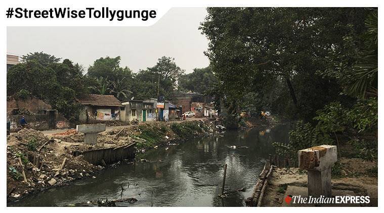
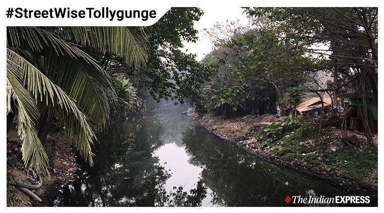
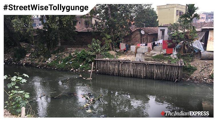
In the outer peripheries of the property that belongs to Tollygunge Club, a narrow creeks snakes past, as if conjoined to the boundaries of the club’s walls. On both banks of the creek, slums have developed over the years and garbage floats on the water, emanating a foul stench.
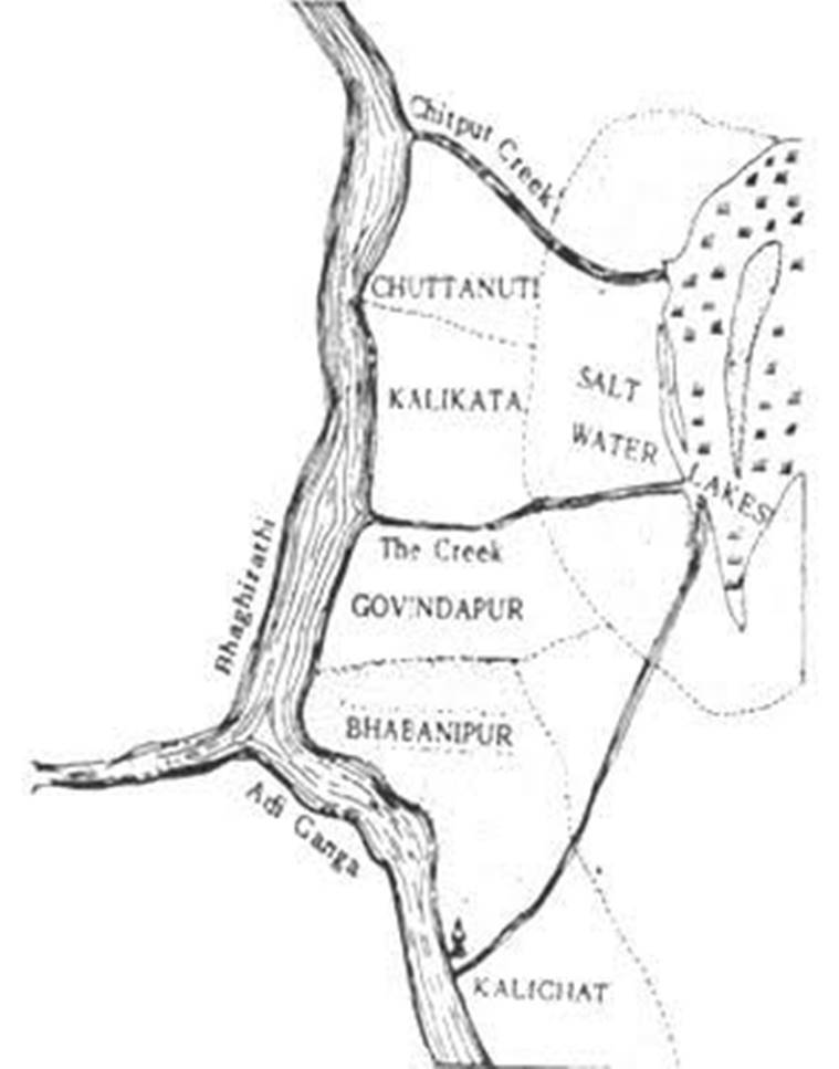
According to historian P Thankappan Nair, who has documented the city’s history extensively, this creek was originally called the Govindpur Creek. There is no historical documentation for why the creek was so named, but perhaps it acquired its name from that of the village of Govindapur, one of the three villages that went on to form the city of Calcutta. According to Nair, another name for this creek in Bengali was Adi Ganga or the original River Ganga that flows past the city.
________________________
In 1775, Colonel Tolly wrote to Warren Hastings, the Governor-General of India, with a proposal of leading an excavation to connect the village of Balliaghat, now called the neighbourhood of Beliaghata, in the wetlands of the eastern fringes of the city, to the neighbourhood of Tollygunge through a waterway.
____________________
According to published letters in the Fort William-India House Correspondence Vol.7 (1773-1776), Tolly wrote to Hastings saying he can do the same on a contract with the East Indian Company or lend his services for Rs 80,000, along with a levy on tolls paid by boats passing through the creek for a period of 12 years. This plan was agreeable to the Company, and Tolly was directed to survey the land. This creek, 27 kilometres long, was then renamed Tolly’s Nullah after the colonel and opened for navigation in 1777.
After the opening of the Nullah, the neighbourhood became more developed and came to be known as Tollygunge. After Tolly’s death, his widow was unable to continue collecting the tolls and the maintenance of the waterways. The Company took over the management of the Nullah and auctioned its leasehold rights in March 1794 to an Englishman in the city, John Hooper Wilkinson. In 1804, the Bengal Government took control over the Nullah and the Collector of 24 Parganas was authorised to maintain it.
__________________________
There is no document to independently verify this fact, but according to the Tollygunge Club archives, the premises of the club was originally an indigo plantation home of Richard Johnson, a merchant in the East India Company, set up in 1781.
Around 1806, the British dispatched Tipu Sultan’s family to Calcutta and gave them a living allowance. Tipu Sultan’s son Ghulam Mohammed Shah purchased the plantation grounds from Johnson to be used as a residence and the family spent a considerable amount of time in the neighbourhood.
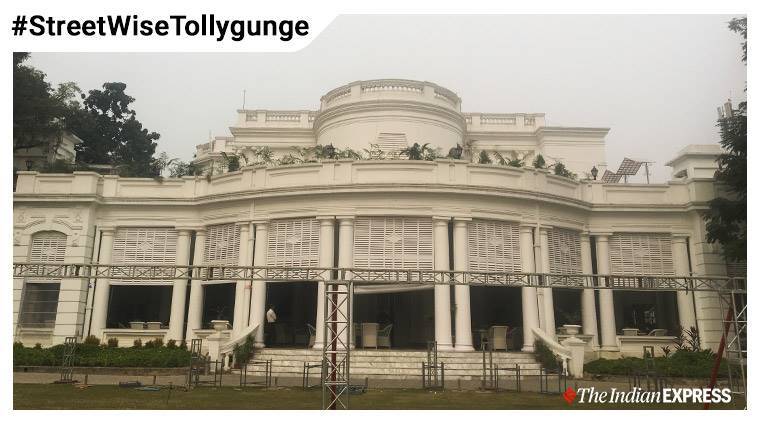
After the family’s fortunes changed, they sold some portions of the plantation and leased out other sections to William Dixon Cruickshank, a Scottish banker, who was looking to build a sports club for the British that would also allow residential facilities and provide space for the British to socialise.
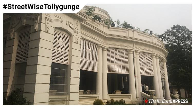
club for the British. (Express photo: Neha Banka)
___________________
Over time, Tipu Sultan’s family divested complete control of the estate and the lands came under the direct control of the Tollygunge Club, a name that the institution acquired because of the neighbourhood it was located in and because of the location of the creek that runs just behind its premises.
Over the decades, most of the open spaces in the club were converted into an 18-hole golf course and the forest land was cleared to make space for other structures and facilities inside the club premises.
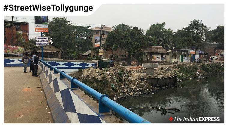
Today, there are no signboards that indicate the location of the Tolly Nullah in the neighbourhood of Tollygunge. Haphazard modern construction has changed the facade of Tollygunge and to find the nullah, one would have to engage in a self-conducted walking tour using an old map of the city for guidance.
An offshoot of the main road in Tollygunge, a narrow lane, through which only one vehicle can pass at a time, is the only way to access the nullah these days. Slums occupy both banks of the waterway and an overwhelming sense of garbage permeates all around. Tollygunge Club itself has changed over the decades and its history can only be found in pockets.
______________________
Although most of the dense forest has been cleared away over the years, jackals still roam its greens in the darkness of dusk and late into the night. On any given day, one can spot diverse species of birds on the club grounds, like kingfishers and cattle egret. Few city residents know of how the institution and its neighbourhood got its name and perhaps even fewer know of the existence of the waterway that lies beyond the high walls of the club.
source: http://www.indianexpress.com / The Indian Express / Home> Cities> Kolkata / by Neha Banka / Kolkata , December 27th, 2019

